Aber Falls
OS Grid Ref:- SH 6670
One of the most majestic sights of the Welsh mountains is Rhaeadr Fawr or Aber Falls as it is known in English. Situated in the foothills of the Carneddau mountain range in a steep sided valley on the Coedydd Aber Nature Reserve near to the village of Abergwyngregyn.
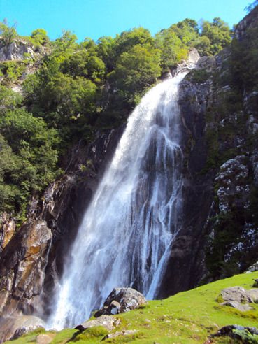
The Afon Goch plunges over an escarpment one hundred and twenty feet high into a marshy area where it is joined by two tributaries; the enlarged stream, Afon Rhaeadr Fawr, heads towards the Menai Strait where it joins the sea. Part of the way way down it becomes Afon Aber Garth Celyn, more recently known as Afon Aber. Torrential after a storm, in winter Aber Falls can freeze enough to attract ice climbers. To reach the falls involves a walk of around a mile up a gently ascending path.
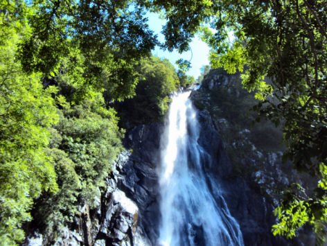
The plentiful spray from the waterfall has encouraged the growth of plants such as wild angelica and lady's mantle, which thrive in the rock crevices around the fall. Choughs, ravens and peregrine falcons can be sighted around the cliff. In the open expanse below the waterfall, which is known as Y Waun, are fragments of rock deposited by glacial action, known as moraines.
A walk to Aber falls
Distance- 4km
*(1) Commencing at the car park at Bont Newydd up the narrow road from Abergwyngregyn, follow the signs leading through a small area of woodland.
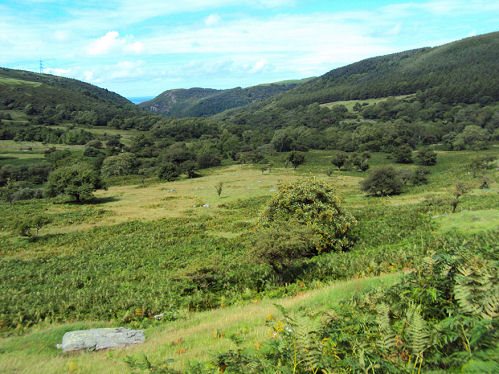
*(2) Emerge from the woodland to follow the clear path along the valley to the falls. Behind you Anglesey can be sighted with Puffin Island at the end.The path splits, allowing a choice of routes, either continue along the path through the valley or take the higher path through the conifer plantation, both merge at the falls.
*(3) After seeing Rhaeadr Fawr, either retrace your steps to return to the car park or take the track leading off to your right to walk the short distance to the further waterfall of Rhaeadr Fach.