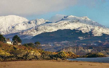
The Moelwyns
The Moelwyn mountain range, referred to in Welsh as the Moelwynian, extend from Porthmadog to the pass known as Bwlch y Rhediad which separates the range from Moel Siabod.
The Moelwyns
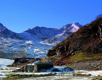
Image reproduced by permission of Derek Fogg, who retains all copyright)
Peaks of the Moelwyns
*Carnedd Moel Siabod 872m (2,861 ft) OS Map grid ref. 115/SH705546
*Allt Fawr 698m (2,290 ft) OS Map grid ref. 115/SH682475
*Moel Druman 676m (2,218 ft) OS Map grid ref. 115/SH671476
*Ysgafell Wenn 672m (2,205ft) OS Map grid ref. 115/SH667481
*Cnicht 689m (2,200ft) OS Map grid ref. 115/SH672454
*Moel-yr-Hydd 648m ( 2,126ft) OS Map grid ref. 124/SH658449
Craigysgafn 689m (2,260') OS Map grid ref. 124/SH660443
*Monad Mawr 661m (2,168ft) OS Map grid ref. 124/SH724447
Moelwyn Bach 710m (2,329ft) OS Map grid ref. 124/Sh660437
*Moel Penamnen 620m (2034') 115/SH716483
The two highest peaks are Moelwyn Mawr, or the Great White Hill, rising to 2,526' (770m) and Moelwyn Bach, which is the smaller of the two at 2,329' (710m). There are many excellent walks in the area which provide excellent views of the surrounding landscape.
Walks in the Moelwyns
*Cnicht Starting from Bwelchgernog, follow the footpath up south ridge to summit of Cnicht.
*Moel Siabod - West flank Beginning at Plas-y-Brenin, east of Capel Curig, follow the path through the forest and remain on the path until reaching the OS trig point at summit of Moel Siabod.
*Moel Siabod- North ridge Commencing at Pont Cyfyng. Cross the river and follow the bridge then the lane on the right, crossing a cattle grid on the track. Head onwards up the gully. Skirt to the right of the rocky section on the way to the summit.
*Moel Siabod - West flank Starting at Pont Cyfyng. Cross the river and follow the bridge then the lane on the right that ascends the hill across a cattle grid and up along the track. At the second gate follow the track passing a lake on the left through the abandoned slate quarry and past a lake on the right. Over a crest a ridge will be seen, head for the base of the ridge ignoring the track up the scree slope. Cross the crest of the ridge and follow the line of the ridge up to the summit, keeping the crest to your right.
*Allt Fawr/ Moel Druman/ Ysgafell Wen Starting from Creosor. From the top of Bwlch y Gorddinian, follow the track up the slope to the summit of Allt Fawr, the follow the electric fence over the summit of Moel Druman and onto Ysgafell Wen.
*Moel Penamnen and Manod Mawr Starting from Creosor. From the top of Bwlch y Gorddinan follow the track up the slope to the summit of Moel Penamnen. The track is not clear so do navigate carefully across the moor. Head east to edge of the forest to commence the walk across to Manod Mawr.
Stay safe by following a few simple rules
* Obtain a reliable local weather forecast prior to setting off and plan a route suitable to those conditions.
* Check your equipment before leaving, take waterproofs, warm spare clothing, hat and gloves, food, drink, a map, a compass and a survival bag.
*Learn basic mountain skills, particularly navigation.
* If weather conditions turn bad, turn back.
* Don't rely on mobile phones.