The Isle of Anglesey
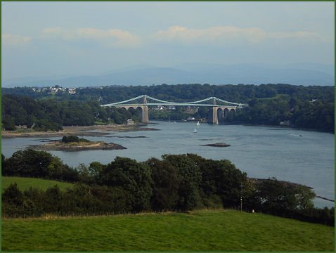
The Isle of Anglesey lies off the the north west coast of Wales near to the stunning Snowdonia National Park. Two bridges span the Menai Strait, connecting the island to mainland Wales, the Menai Suspension Bridge which was designed by Thomas Telford in 1826 and the Britannia Bridge.
The name Anglesey dates back to the tenth century and is of Old Norse origin, meaning 'Ongull's Island'. The island is known in Welsh as Ynys Môn, which derives from the British enisis mona, first appearing in the Roman era as 'Mona'.
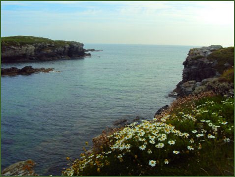
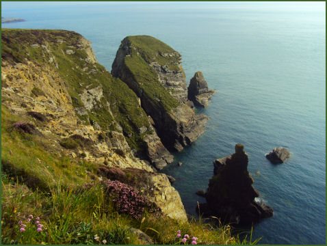
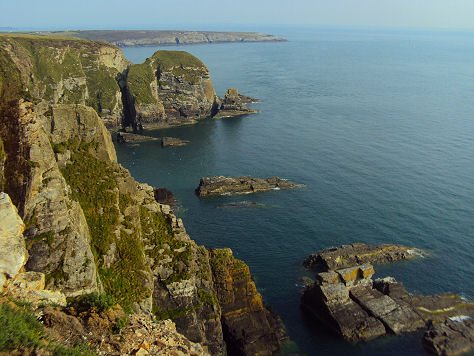
Anglesey's entire rural coastline has been designated an Area of Outstanding Natural Beauty and features a wealth of sandy beaches, especially along its eastern coast between the towns of Beaumaris and Amlwch and along the western coast from Ynys Llanddwyn through Rhosneigr to the bays around Carmel Head. The northern coastline is characterised by spectacular cliffs. The island of South Stack, known in Welsh as Ynys Lawd is located just off Holy Island on the North West coast of Anglesey. The cliffs of South Stack abound with bird life, each summer 4000 birds visit the area, seals or dolphins have also been spotted from the island. Cemlyn Bay Nature Reserve, situated about 3 miles from Cemaes on the spectacular northwest coast of Anglesey, is an important tern colony, with the only breeding Sandwich Terns in Wales and the third largest in Britain. . Arctic and Common Terns also breed at the reserve, as occasionally does the Roseate Tern.
Left North Stack, Holy Island and right Trearddur Bay
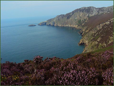
The Anglesey Coastal Path is a 200-kilometre (124 mile) long distance footpath which follows nearly the entire coastline of the island. It passes through a varying landscape that includes farmland, coastal heath, dunes, salt-marsh, foreshore, cliffs and a few small pockets of woodland.
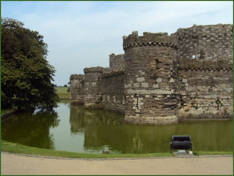
The island has several towns. The historic town of Beaumaris, which name derives from the Anglo-Norman Beau Mareys meaning 'beautiful marsh', was originally a Viking settlement and is now a yachting centre for the area. Beaumaris is the site of one of the castles built by King Edward I as part of his campaign to conquer North Wales. Beaumaris Castle was designed by Edward's military architect, James of St. George and was begun in 1295, but was never completed. The most technically perfect medieval castle in Britain, Beaumaris was the last link in the chain of coastal fortresses built by the king to control his Welsh conquests. Beaumaris, along with the nearby castles of Harlech, Conwy and Caernarfon, is a World Heritage Site.
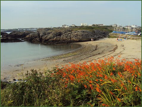
The village of Newborough, known in Welsh as Niwbwrch, situated in the south of Anglesey, was created when the people of Llanfaes were evicted by Edward I to make way for the building of Beaumaris Castle, it includes the site of Llys Rhosyr, once a court of the medieval Welsh princes, which boasts one of the oldest courtrooms in Britain. The small town of Benllech on the east coast of Anglesey is a popular seaside resort which has one of the island's most beautiful beaches overlooking Penmon and Red Wharf Bay. The beach has been winner of the Blue Flag award since 2004, it is a popular spot for sea canoeing and surfing. The extensive beach at Trearddur Bay, also winner of the Blue Flag Award, is one of the most popular beaches on the island.
Left the Menai Bridge and right Sea Cliffs at South Stack
Plas Newydd, the country seat of the Marquess of Anglesey, is situated at Llanfairpwllgwyngyll, on the south east of Anglesey, adjacent to the Menai Strait. The house contains many of the works of the artist Rex Whistler, who had been a close friend of the 6th Marquess and stayed at Plas Newydd in the 1930's. He painted his largest mural (58 feet long), which is still displayed in the house, it depicts the scenery surrounding the estate. There is also a Military Museum which contains campaign relics belonging to the 1st Marquess of Anglesey, who commanded the cavalry in the battle of Waterloo, and the Anglesey Leg.
Penmon Priory and Beaumaris Castle
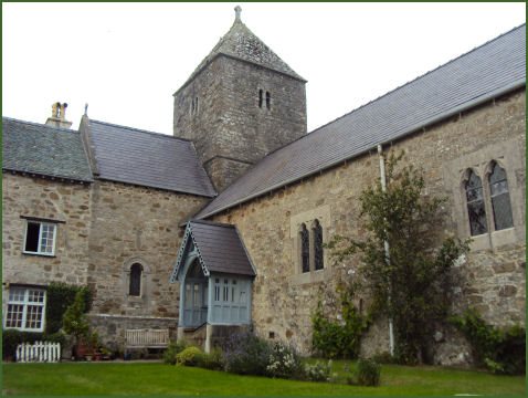
Atmospheric Penmon Priory, about 7 miles to the north-east of Beaumaris, was founded by St. Seriol in the sixth century, the abbey church and conical tower we see today date back the twelfth century. Nearby St. Seriol's Well was a place of pilgrimage in medieval times.
Llynnon Mill or Melin Llynnon in Welsh is situated near the village of Llanddeusant in the northwest of Anglesey. The mill is the only working windmill in Wales, now an agricultural museum producing stoneground wholemeal flour using organic wheat. Two roundhouses have been constructed at the Llynonn Mill, which were completed in 2007. The roundhouses measure 10 metres in diameter and are built from oak and hazel with wattle and daub walls and a thatched roof, they provide a unique insight of the life of Iron Age farmers over 3,000 years ago.
Anglesey has large number of prehistoric monuments, testifying to its population since the Stone Ages. One of the best of these sites and one of Wales' most famous ancient monuments, is Bryn Celli Ddu, a Neolithic burial chamber, referred to in Welsh as a cromlech and is situated a few miles to the south east of the village of Llanddaniel Fab. Its name translates as 'the mound in the dark grove'. The first evidence of humans being on the island comes from the Mesolithic period, about 7000 BC. The Din Lligwy hut circle is an ancient settlement situated near to the village of Moelfre, on the east coast of Anglesey. The name Din refers to its surrounding protective wall. The well preserved settlement may date back to the Iron Age and was probably a small farming community, archaeological evidence suggests it was occupied up to the Romano-British period.
Left, the cliffs at Holy Island and right Trearddur Bay
The island has long been associated with the ancient Celtic druids and was one of the last strongholds of the Celts. In AD 60 the Roman general Gaius Suetonius Paulinus, in attempt to break the power of the druids, crossed the Menai Strait, attacked Anglesey, massacred the druids and destroyed the shrine and the sacred groves. The Roman historian Tacitus gives an account of the battle which took place on the shores of the Menai Straits:-
'By the shore stood an opposing battle-line, thick with men and weapons, woman running between them, like the Furies in their funereal clothes, their hair flowing, carrying torches; and Druids among them, pouring out frightful curses with their hands raised high to the heavens, our soldiers being so scared by the unfamiliar sight that their limbs were paralysed, and they stood motionless and exposed to be wounded.'
When the Romans left Britain in the early fifth century, Anglesey was colonised by pirates from Ireland, after a drawn out struggle the last Irish invaders were defeated in battle in 470. The island was further invaded by Vikings, some of these raids were recorded in the famous sagas. It was finally conqured by King Edward I of England in the thirteenth century.