Swallow Falls
OS gid ref. SH 776 591
Swallow Falls is the highest continuous waterfall in Wales. The falls are set on the River Llugwy two miles west of Betws-y-Coed along the A5 to Capel Curig, in the beautiful Gwydir Forest.
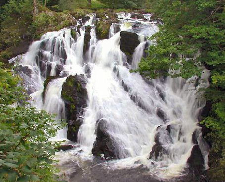
Swallow Fall's is one of Snowdonia's most visited sights. Rising among the towering peaks of Carnedd Llewellyn the River Llugwy runs eastward towards Capel Curig and Betws-y-Coed, before reaching Swallow falls, which has long been one of the most visited beauty spots in the area.
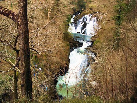
The waterfall can be reached from the car park on the other side of the A5, where there are viewing platforms and safety rails, an alternative approach on foot can be taken along the north bank of the river, which is a spectacular, if difficult to traverse walk.
A walk through the Gwydyr Forest to Swallow Falls
Distance - 4 miles
Duration - Around 2 hours
*Commencing at the parking and picnic area at Cae'n-y-Coed on the A5 between the villages of Betws-y-Coed and Capel Curig (OS grid reference:- SH 761 575), from the lower part of the car park, proceed uphill to the right and then turn left, climbing up steps to to continue along a forestry road.This part of the route offers superb views of the often cloud capped Moel Siabod.
*Having passed through the woods, continue to ascend the raise, from where there are stunning views of the Llugwy Valley, the Snowdon range and other mountains of northern Snowdonia. Continue to follow along the path, descending the hill and re-entering another area of woodland.
*Follow the fence on the left of the track, turning right onto a forestry road. Follow the red topped forest way markers to return to the car park.
*Continue down to the main road and turn right. Swallow Falls are situated opposite the large hotel. In the summer months there is often a queue to see the falls.